Project Overview
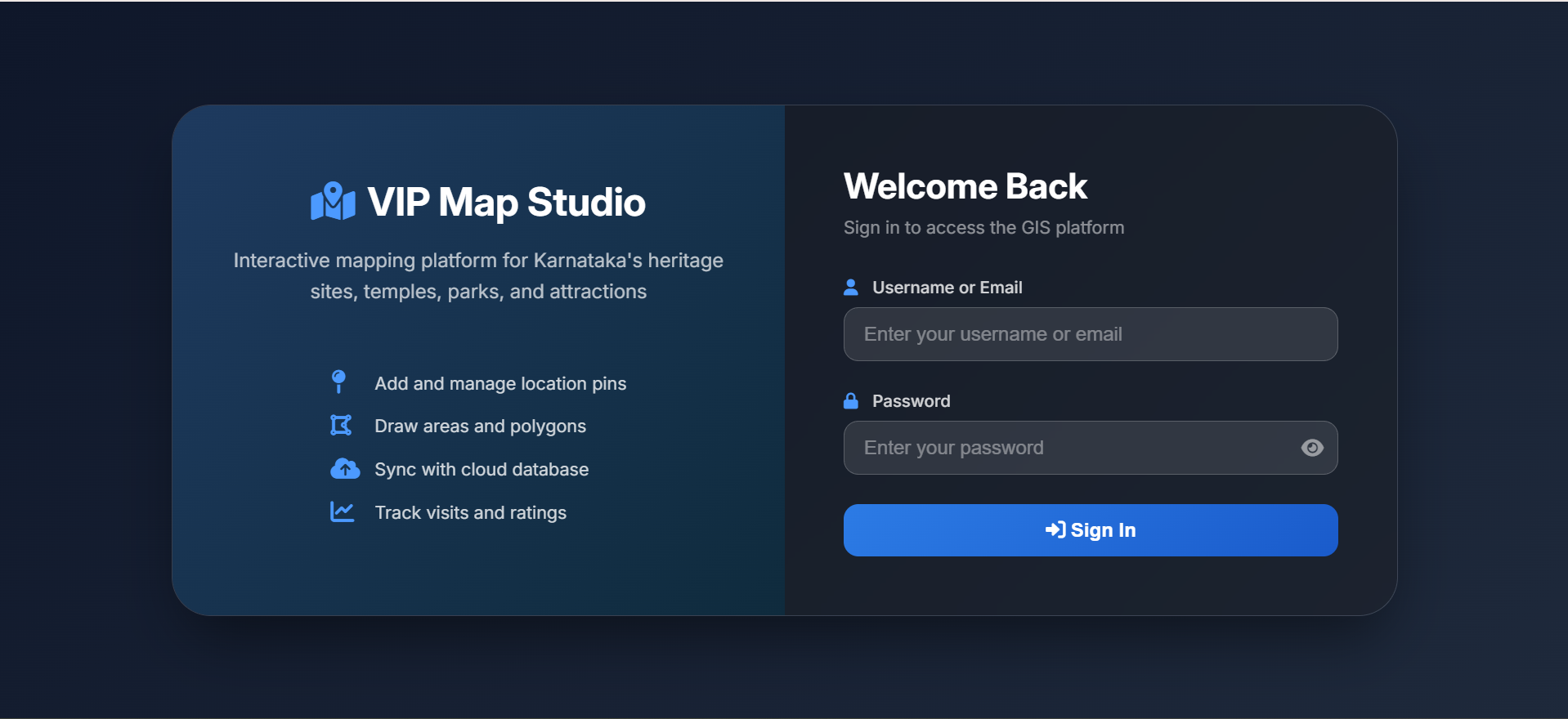
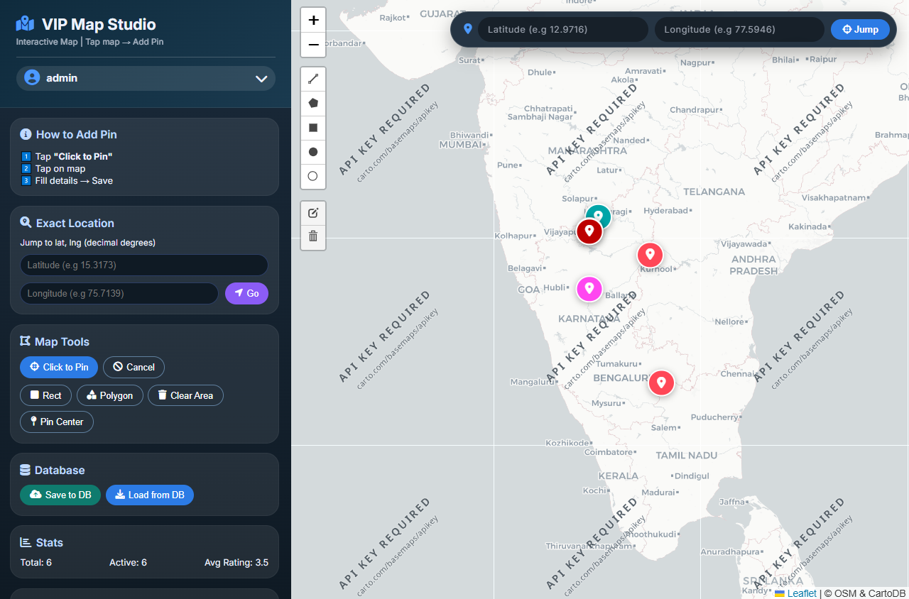
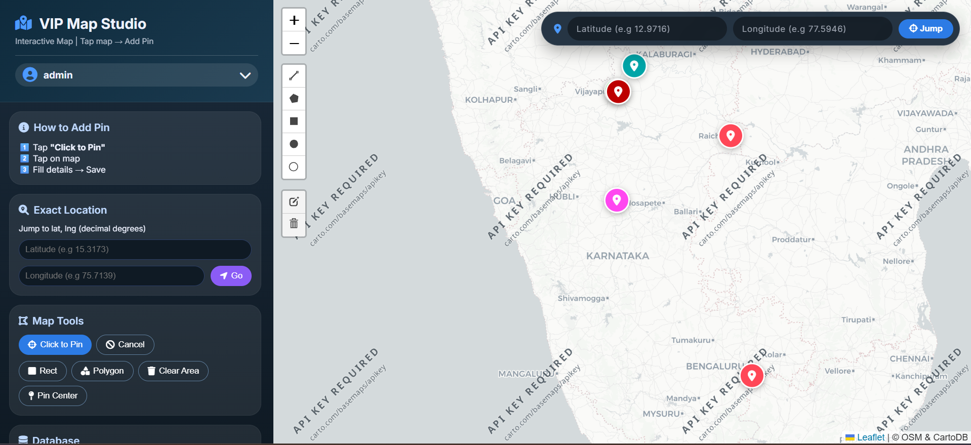
VIP Map is an interactive mapping and GIS management platform designed to help users create, manage and visualize locations, heritage sites, temples, parks and other attractions on an interactive map. The platform provides tools for adding and managing location pins, drawing geographical areas and polygons, synchronizing mapping data with a cloud database, and tracking visits and ratings.
The platform also includes a management dashboard that provides access to the GIS platform and allows administrators to manage map-related information and location data from a centralized system.
Main Concept
Admin → Dashboard → Map Data → Locations & Areas → Interactive Map → Users
The administrator manages locations, map data and geographical areas through the dashboard, while users can interact with the map and explore different locations and attractions.
Full Project Description
1. Interactive Map Platform
VIP Map provides an interactive mapping platform for managing and displaying geographical locations.
The platform is designed especially for mapping:
- Heritage sites
- Temples
- Parks
- Tourist attractions
- Important locations
- Other points of interest
The system allows geographical information to be organized and displayed through an interactive map interface.
2. Map Management Dashboard
The management dashboard is the main administrative component of the platform.
Administrators can access the GIS platform through a secure login system and manage mapping-related information from a centralized interface.
The platform provides functionality for:
- Location management
- Location pin management
- Map data management
- Geographical area management
- Polygon management
- Interactive map management
- Cloud database synchronization
- Visit tracking
- Rating tracking
- GIS data management
- Dashboard-based administration
This makes VIP Map more than a simple map viewer. It functions as an interactive GIS and location management platform.
3. Location Pin Management
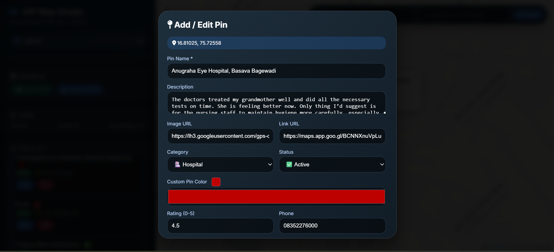
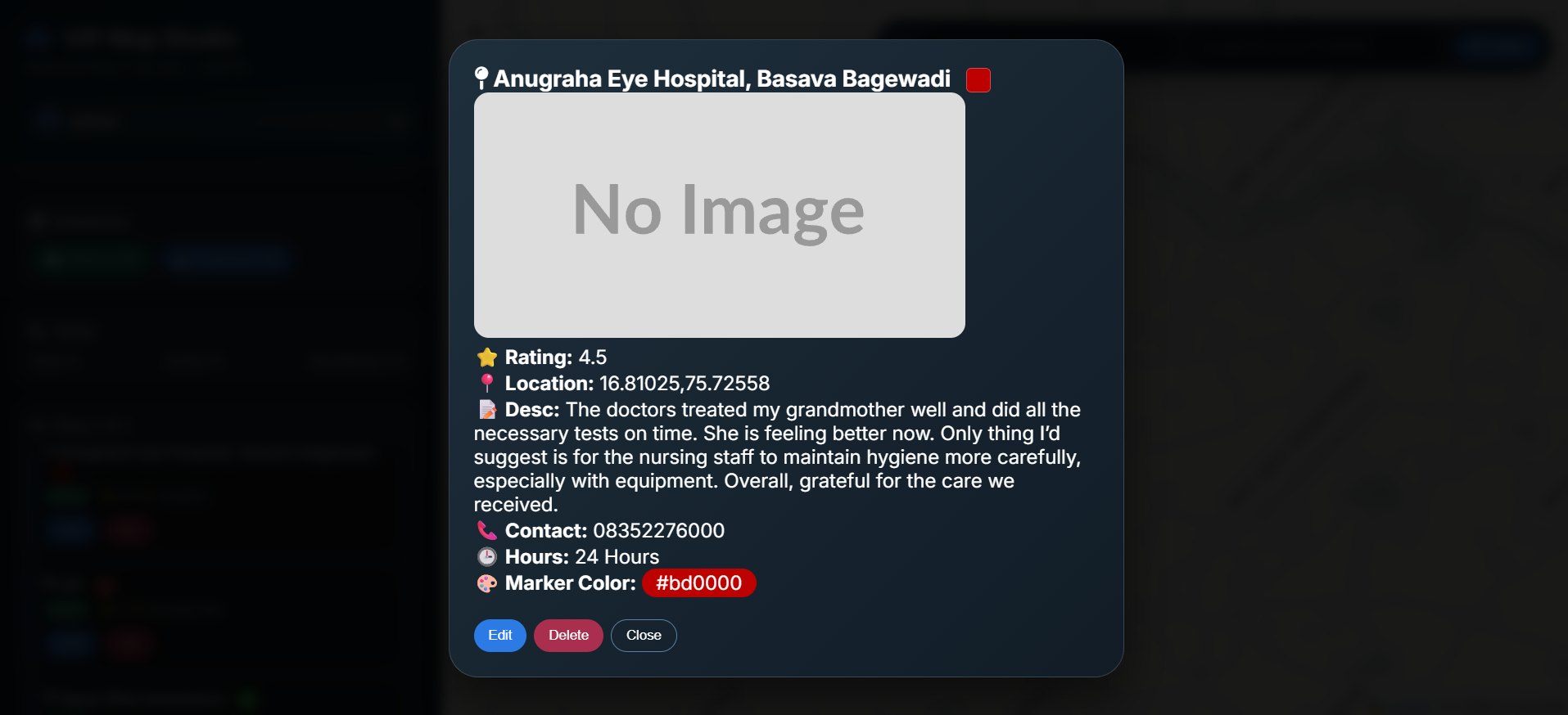
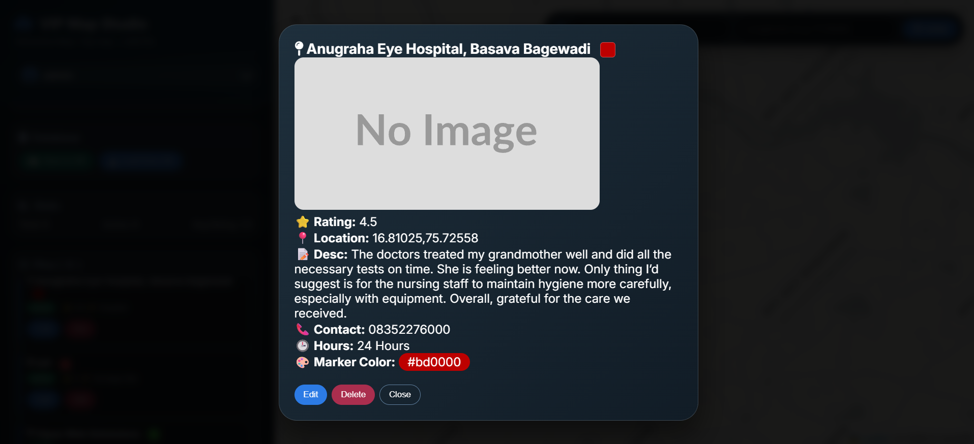
One of the main features of VIP Map is the ability to add and manage location pins on the interactive map.
Administrators can use location pins to identify important places and points of interest such as:
- Temples
- Heritage locations
- Parks
- Tourist destinations
- Historical places
- Other attractions
This allows geographical locations to be organized and displayed in an easy-to-understand visual format.
4. Area and Polygon Management
VIP Map provides tools for drawing areas and polygons on the map.
This functionality can be used to represent geographical boundaries, regions, zones or specific areas on an interactive map.
Administrators can use map-based drawing tools to create geographical shapes and organize spatial information.
5. Cloud Database Synchronization
The platform supports cloud database synchronization, allowing map-related information to be synchronized with a centralized database.
This helps maintain mapping data and ensures that location information can be managed through the GIS platform.
6. Visit Tracking
VIP Map includes functionality for tracking visits to mapped locations.
Visit information can help administrators understand how users interact with different locations and attractions on the platform.
This can be useful for identifying popular destinations and understanding user interest in different mapped locations.
7. Rating Management
The platform also supports rating tracking, allowing ratings associated with locations or attractions to be monitored.
This can help provide additional information about user interaction and feedback for different mapped places.
8. Heritage Site Mapping
VIP Map is specifically designed to support mapping of Karnataka heritage sites.
The platform can be used to organize heritage locations geographically and provide users with an interactive way to explore these places.
9. Temple Mapping
The platform can also be used for mapping temples across different locations.
Each temple can be represented as a location on the interactive map, allowing users to discover and explore mapped religious and cultural destinations.
10. Park and Attraction Mapping
VIP Map supports mapping of parks and other attractions.
This allows different categories of locations to be organized within the same interactive mapping platform and displayed geographically for easier exploration.
11. GIS Platform
VIP Map functions as a GIS-based mapping platform that combines geographical data with an interactive map interface.
The system provides tools for managing:
- Points
- Locations
- Areas
- Polygons
- Map information
- Geographical data
- Visit information
- Ratings
The platform provides secure sign-in access to the GIS system through its management interface.
User Experience
The platform is designed to make geographical information easier to explore and manage.
A typical workflow can be represented as:
Admin → Add Location → Manage Map Data → Draw Area/Polygon → Synchronize Data → Interactive Map → User Exploration
Administrators manage the geographical information, while users can explore mapped locations and attractions through the interactive mapping experience.
Business Benefits
Centralized Map Management
VIP Map provides a centralized platform for managing locations and geographical information.
Interactive Location Discovery
Users can explore different locations through an interactive map instead of relying only on traditional lists.
Heritage Preservation
The platform can help organize and digitally represent Karnataka heritage sites and cultural locations.
Location-Based Information
Mapped locations provide a visual geographical representation of important places and attractions.
Easy Geographical Data Management
Administrators can add location pins and draw areas or polygons directly within the mapping platform.
Cloud-Based Data Management
Cloud database synchronization helps maintain and manage mapping information from a centralized system.
Visit and Rating Insights
Visit and rating tracking can provide useful insights into user engagement with mapped locations.